

Welcome to Alpine Airpark 46U,
a breathtaking adventure-driven residential fly-in community nestled in the scenic beauty of Alpine, Wyoming, just 35 miles south of Jackson Hole.
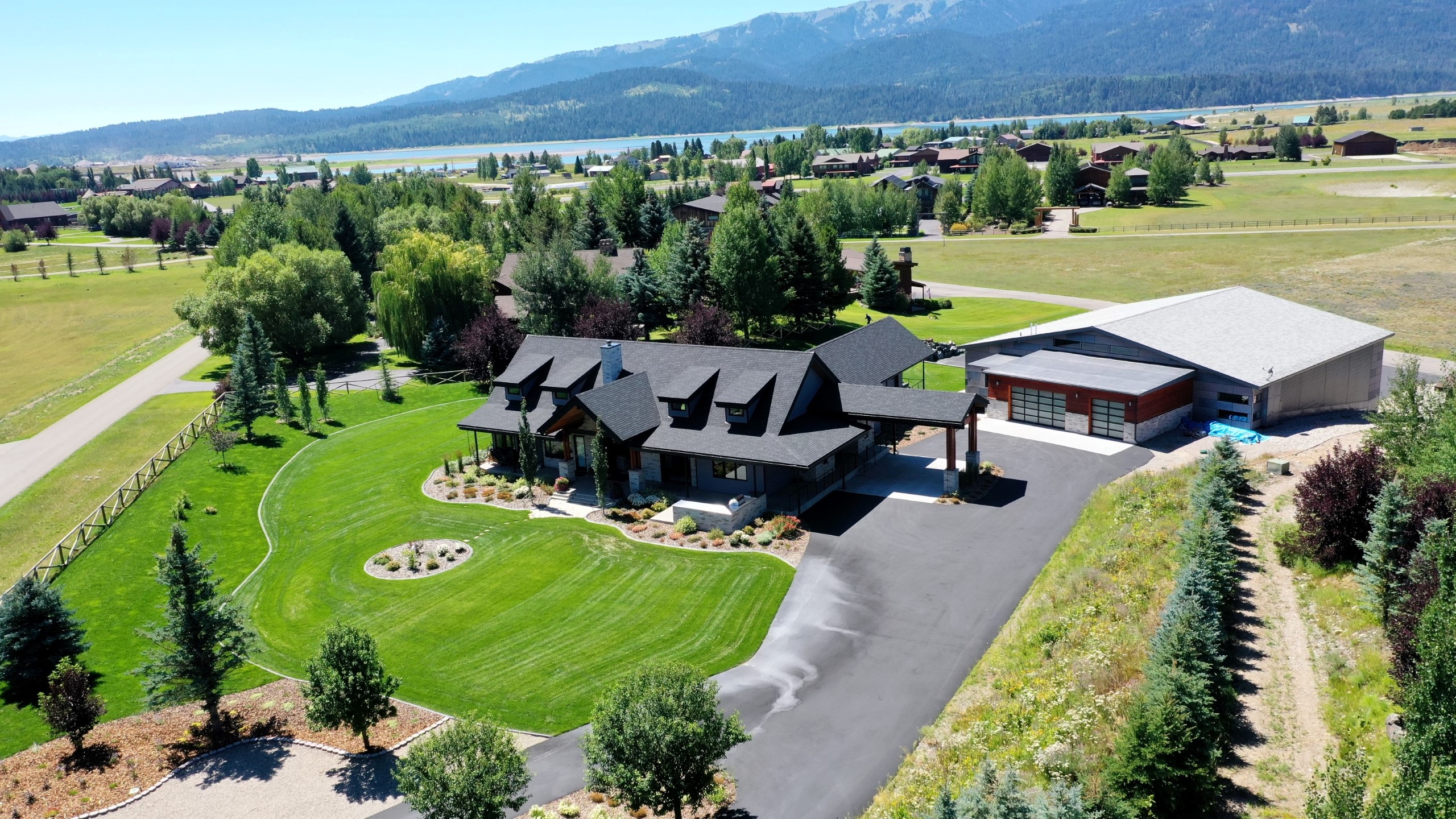
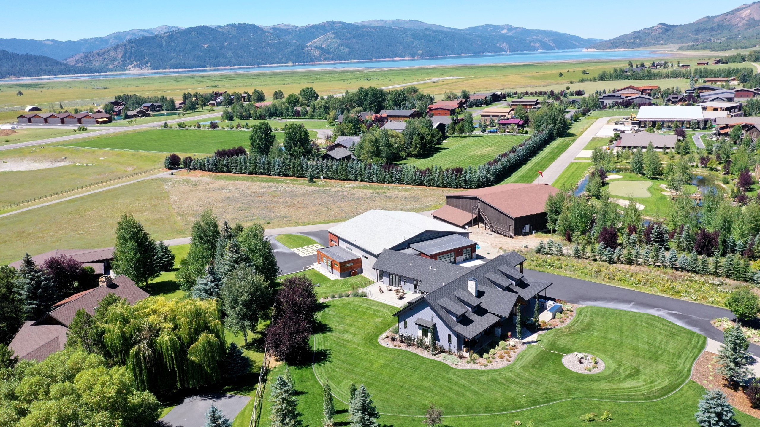
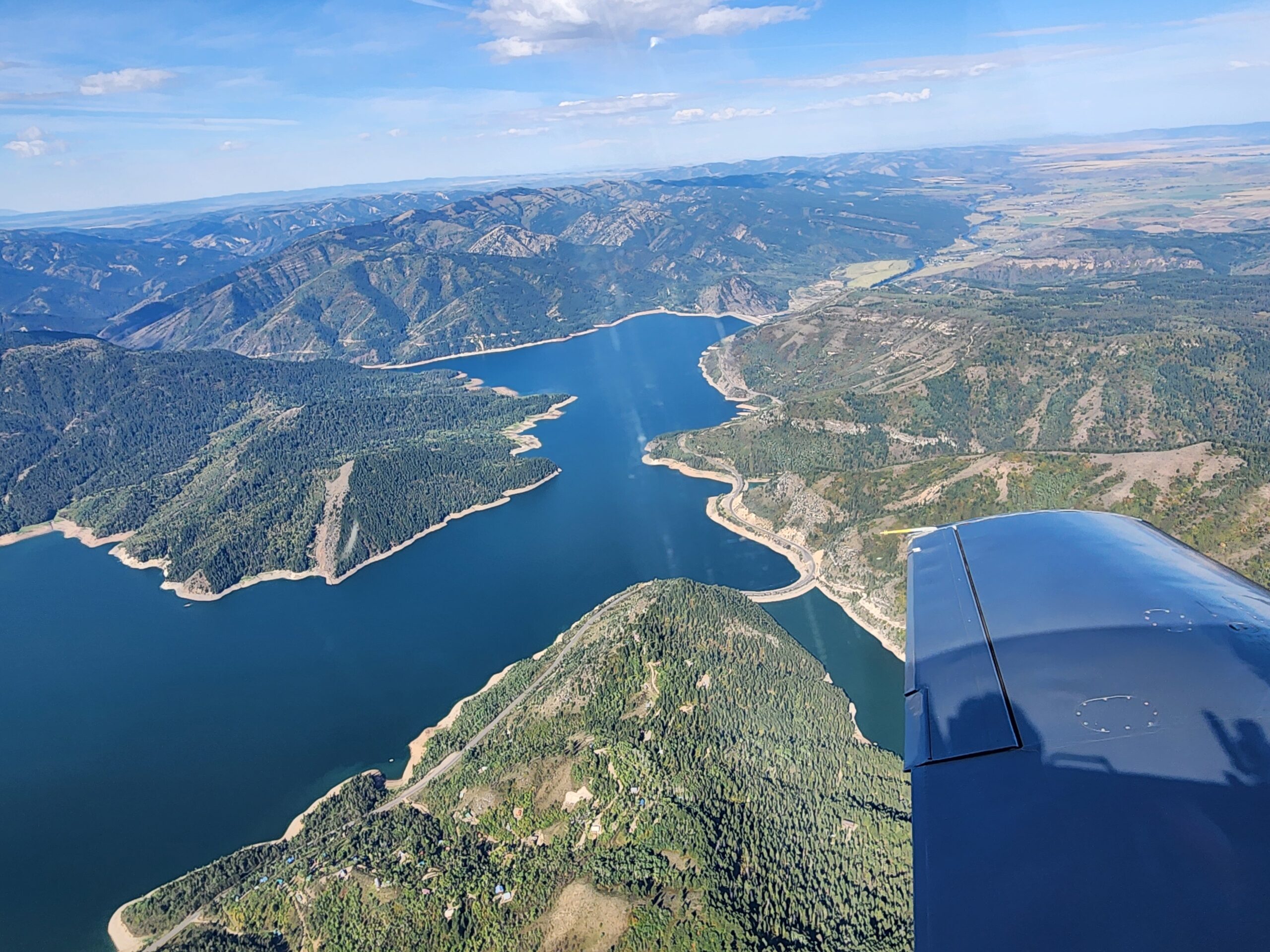
Welcome to Alpine Airpark 46U, a breathtaking adventure-driven residential fly-in community nestled in the scenic beauty of Alpine, Wyoming, just 35 miles south of Jackson Hole. Immerse yourself in the charm of Alpine, where the town rests gracefully against the mountainsides, embraced by the convergence of three magnificent rivers – the Greys, the Salt, and the Snake River. These awe-inspiring waterways merge and flow into the picturesque Palisades Reservoir, creating an idyllic setting for your luxury airpark hangar home.
At Alpine Airpark, we redefine opulent living, offering high-end clients the most exquisite real estate experiences. Our exclusive properties go beyond luxurious living spaces; they embody the essence of your dream lifestyle.
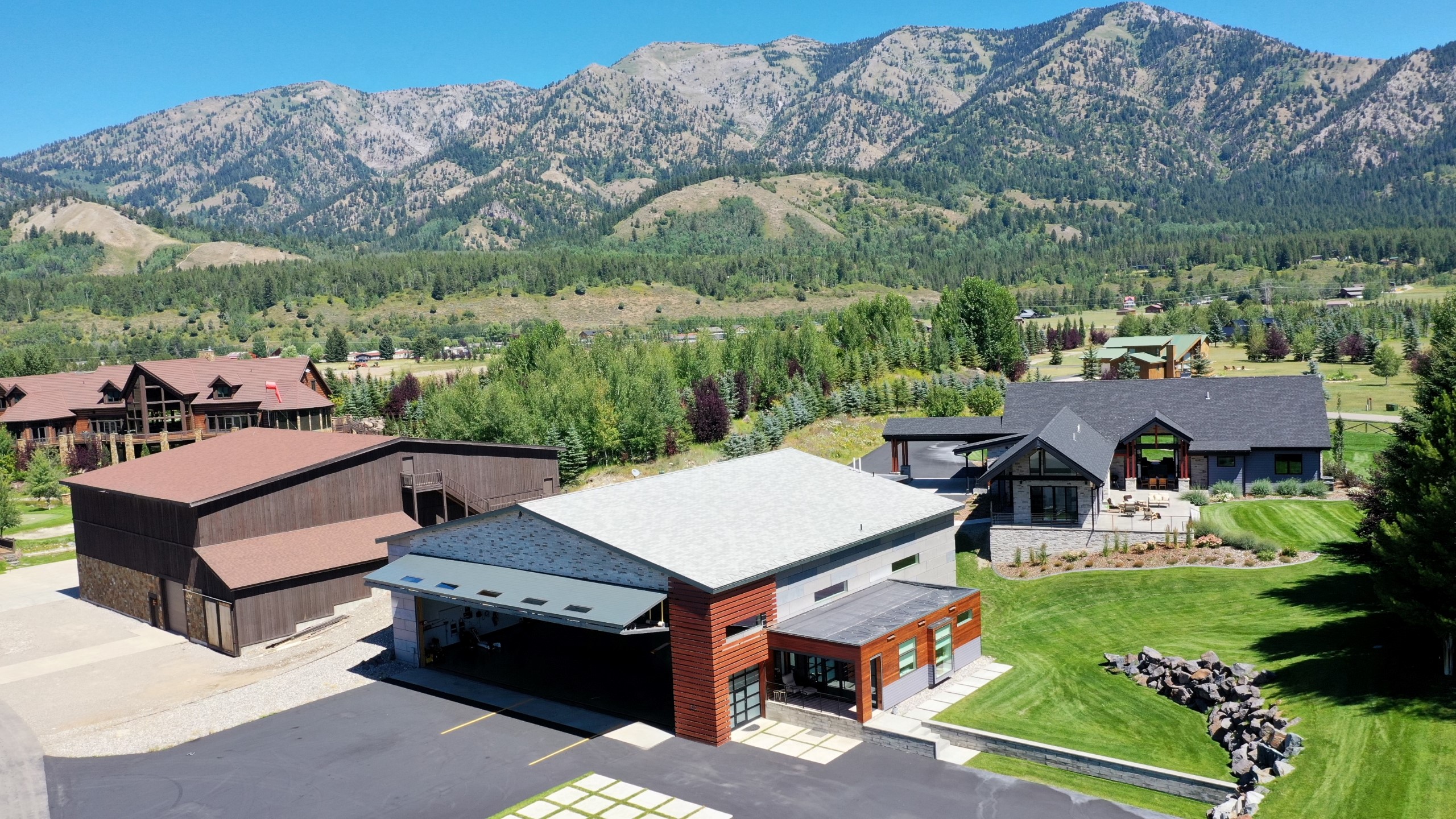
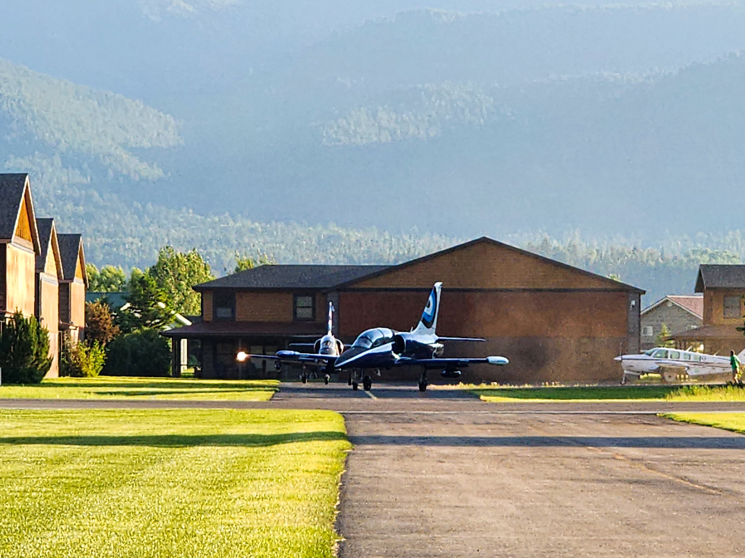
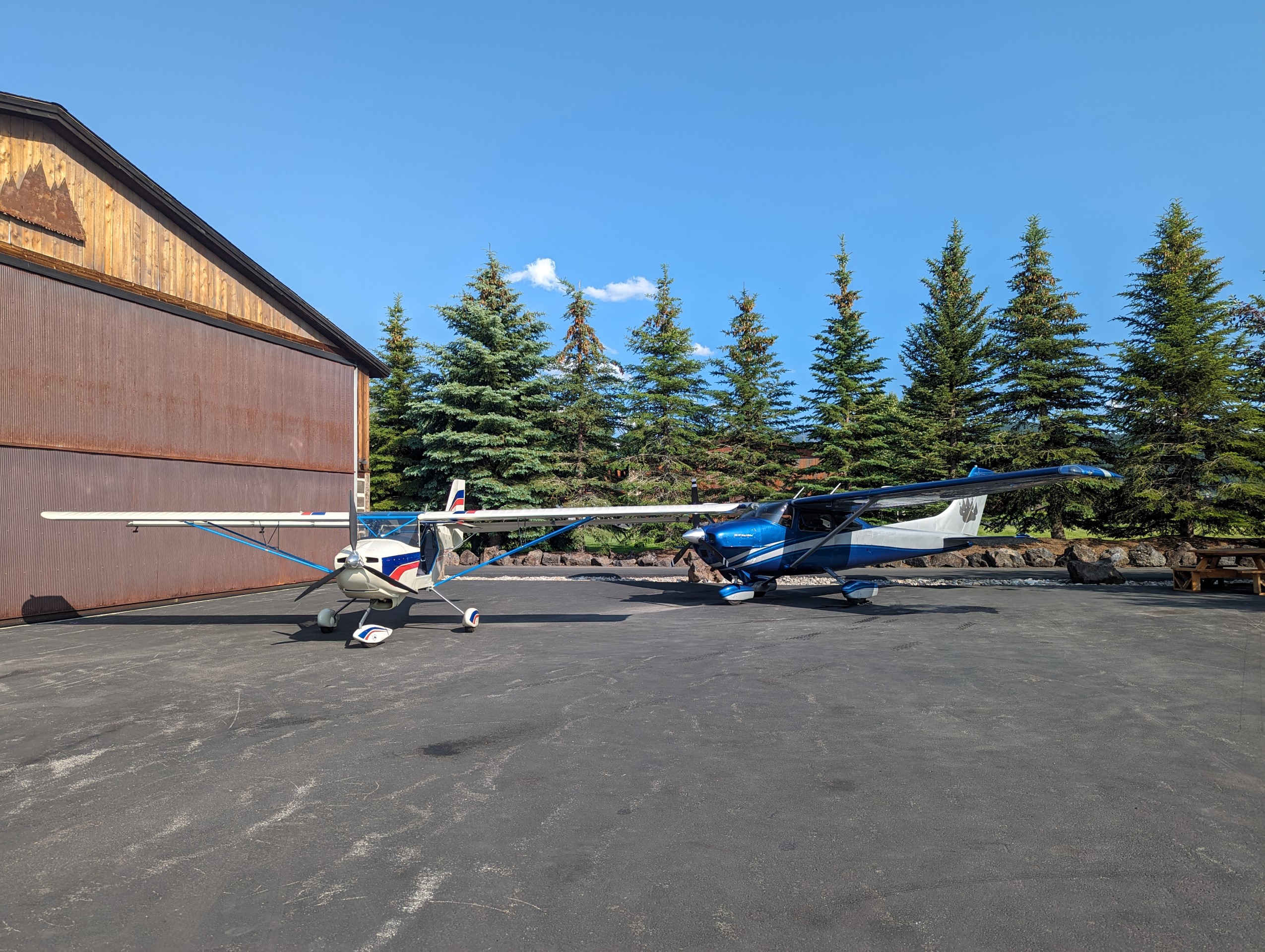
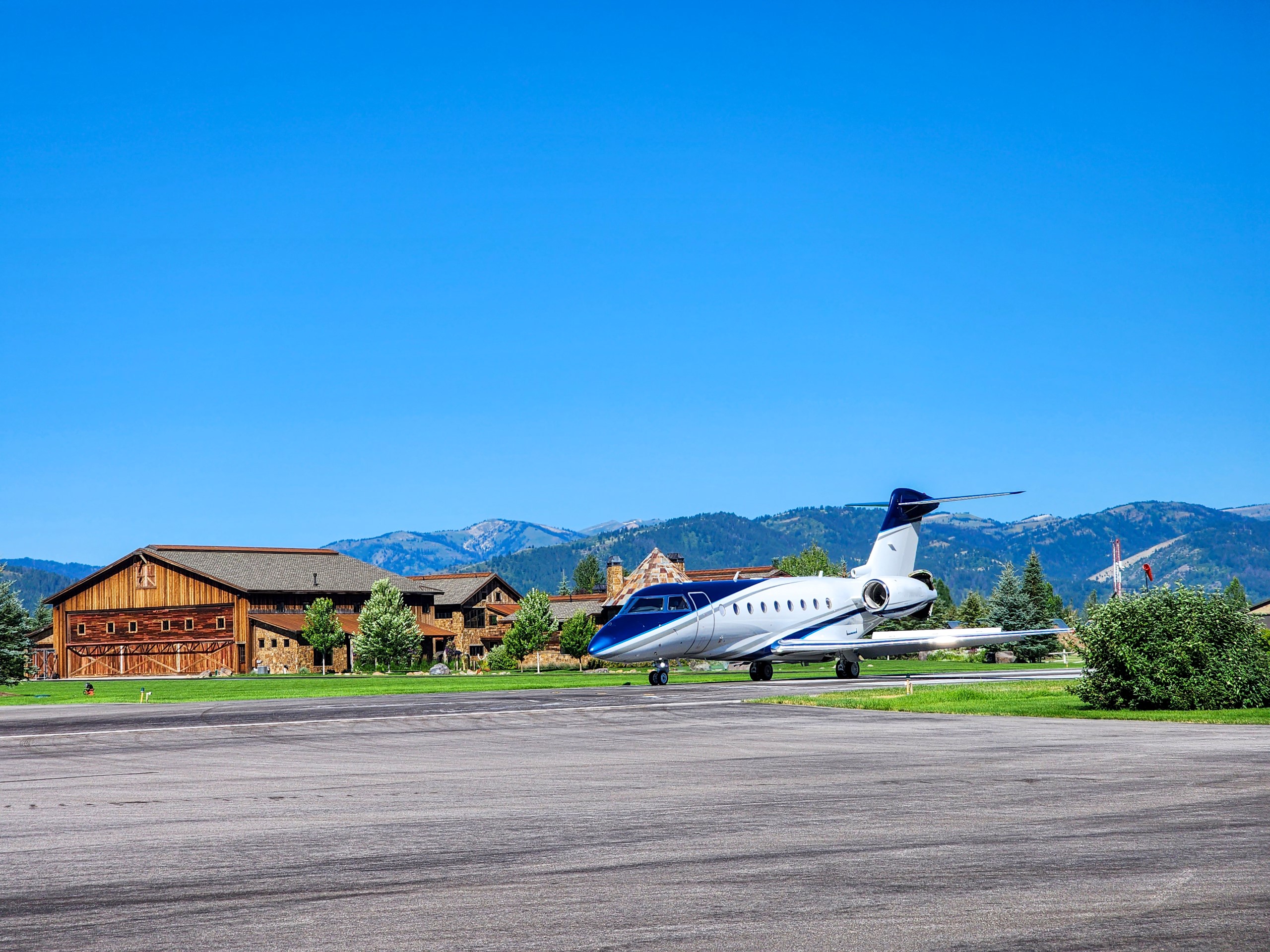
Passionate aviator or aviation enthusiast, you'll find unparalleled convenience as our luxury airpark hangar homes provide direct access to private runways, effortlessly fulfilling your desire to soar the skies.
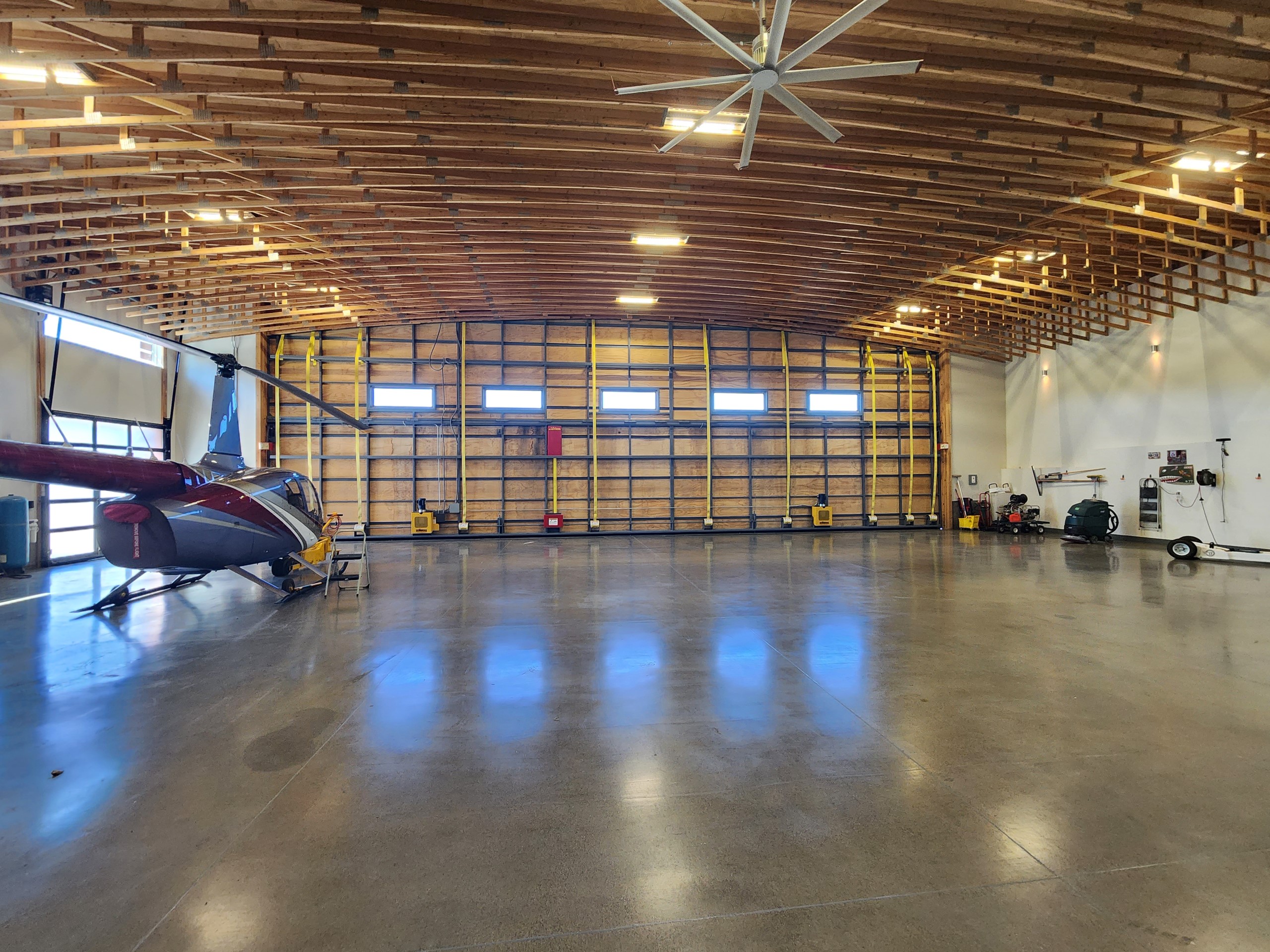
Indulge yourself in the lap of luxury with our spacious hangars, perfectly designed to accommodate your private aircraft. As an adventure-driven community, we also offer a wealth of local amenities to cater to your thrill-seeking spirit.
Privacy and security are paramount at Alpine Airpark, ensuring a serene living environment where exclusivity becomes a way of life.
Rest assured, our team of dedicated real estate experts understands the refined tastes of high-end clients, meticulously curating a collection of airpark hangar homes that exceed every expectation.
Experience the epitome of luxury living as you take flight with our exclusive selection of airpark hangar homes. Here, the allure of aviation merges seamlessly with sophisticated living, a lifestyle reserved for those who seek the extraordinary.
Embark on this unparalleled journey today and secure your place in the world of luxury airpark living. Your dream home awaits.
For more information and to explore these exceptional properties, don't hesitate to contact us. Together, let's make your dreams take flight in the exclusive Alpine Airpark community.
Private Listings Available
Call Zachary Miller, Owner/Broker, REALTOR® for additional Private Listings available.
Alpine Airpark 46U - Airport Hangar Homes
Alpine Airpark 46U & Alpine Refuge Air Ranch Land Available
Nearby Airport Locations:
Afton, WY Airpark Hangar Homes
Driggs, Idaho Hangar Homes Available
Click Below to enjoy a 360 VR View of Alpine Airpark 46U
Interested in Alpine Airpark 46U Hangar Homes?
Call Us- We have off market hangar home properties available as well.
Location
| FAA Identifier: | 46U |
| Lat/Long: | 43-10-54.5000N 111-02-18.6000W 43-10.908333N 111-02.310000W 43.1818056,-111.0385000 (estimated) |
| Elevation: | 5637 ft. / 1718.2 m (surveyed) |
| Variation: | 11E (2020) |
| From city: | 1 mile NW of ALPINE, WY |
| Time zone: | UTC -6 (UTC -7 during Standard Time) |
| Zip code: | 83128 |
Airport Operations
| Airport use: | Open to the public |
| Activation date: | 12/1971 |
| Control tower: | no |
| ARTCC: | SALT LAKE CITY CENTER |
| FSS: | CASPER FLIGHT SERVICE STATION |
| NOTAMs facility: | CPR (NOTAM-D service available) |
| Attendance: | UNATNDD |
| Wind indicator: | yes |
| Segmented circle: | no |
| Lights: | ACTVT PAPI RWY 13; MIRL RWY 13/31 - CTAF |
Airport Communications
| CTAF: | 122.9 |
| WX AWOS-3: | 119.925 (307-654-2004) |
Nearby radio navigation aids
| VOR radial/distance | VOR name | Freq | Var | |||
|---|---|---|---|---|---|---|
| JACr194/29.6 | JACKSON VOR/DME | 115.40 | 13E |
Airport Services
| Fuel available: | 100LL JET-A 24 HR SELF SVC FUEL AVBL WITH CREDIT CARD. FULL SVC JET A & AVGAS ALSO AVBL. |
| Parking: | hangars and tiedowns |
| Airframe service: | NONE |
| Powerplant service: | NONE |
| Bottled oxygen: | NONE |
| Bulk oxygen: | NONE |
Runway Information
Runway 13/31
| Dimensions: | 5827 x 70 ft. / 1776 x 21 m | ||||
| Surface: | asphalt, in good condition | ||||
| Weight bearing capacity: |
|
||||
| Runway edge lights: | medium intensity | ||||
| RUNWAY 13 | RUNWAY 31 | ||||
| Latitude: | 43-11.286988N | 43-10.529475N | |||
| Longitude: | 111-02.712137W | 111-01.908645W | |||
| Elevation: | 5624.4 ft. | 5636.9 ft. | |||
| Traffic pattern: | right | left | |||
| Runway heading: | 131 magnetic, 142 true | 311 magnetic, 322 true | |||
| Displaced threshold: | no | 466 ft. | |||
| Markings: | nonprecision, in good condition | nonprecision, in good condition | |||
| Visual slope indicator: | 2-light PAPI on left (3.00 degrees glide path) | ||||
| Touchdown point: | yes, no lights | yes, no lights | |||
| Obstructions: | none | 19 ft. road, 200 ft. from runway, 1:1 slope to clear 16 FT PAVED ROAD 106 FT FM RWY END CROSSES RWY END. |
|||
Airport Ownership and Management from official FAA records
| Ownership: | Privately-owned |
| Owner: | ALPINE AIRPARK, LLC 592 AIRPORT DRIVE, UNIT 3 ALPINE, WY 83128 Phone 307-654-4646 NW 1500 FT OF RWY 13/31 ON U.S. FOREST SER PROPERTY. |
| Manager: | LYNN FERGUSON PO BOX 3386 ALPINE, WY 83128 Phone 307-654-4646 |
Airport Operational Statistics
|
|
||||||||||||||||||||||||||
Additional Remarks
| A30A-31 | RWY 13/31 FENCES, BLDGS & TREES WI 150 FT N & S OF CNTRLN. |
| - | ARPT CLSD NGTS |
| - | AVOID LOW LEVEL FLT OVER CITY OR EAST OF RWY, |
| - | FBO FAC, HNGR SPACE & RAMP SPACE AVBL. |
| - | NOISE SENS ARPT. |
| - | ARPT RWY 70000 LB MAX GWT AIRCRAFT LMT, FBO RAMP 80000 LB MAX SNGL WHEEL LMT, REFUGE TWY 50000 LB MAX GWT. OTH RESIDENTIAL TWYS ESTAB THEIR OWN WT LMTS AND RQR APVL PRIOR TO USE. |
| - | FOR CD CTC SALT LAKE ARTCC AT 801-320-2568. |
| - | VOLUNTARY CURFEW DUSK TO DAWN. NGT LDGS LMTD TO AIRPARK RESIDENTS ONLY. NGT TIME LDGS AND TKFS NOT ADVS TO PILOTS UNFAMILIAR WITH TRRN. WILDLIFE ON AND INVOF OF ARPT. BIRD/WATERFOWL HAZ. |
| - | FOR RWY COND IN WINTER CTC - AMGR. |
| - | VRB RWY COND AND BA WINTER MOS. SNBNK ALG RWY AND TWY EDGES POSS FALL, WINT, SPRING MOS. TREACHEROUS MTN TERR IN CLOSE PROXIMITY ALL QUADS OF RWY. WX PMTG LND RWY 13 TKOF RWY 31. |
Instrument Procedures
There are no published instrument procedures at 46U.
Some nearby airports with instrument procedures:
KAFO - Afton Municipal Airport (29 nm S)
KJAC - Jackson Hole Airport (29 nm NE)
KDIJ - Driggs-Reed Memorial Airport (34 nm N)
KIDA - Idaho Falls Regional Airport (49 nm NW)
KRXE - Rexburg-Madison County Airport (51 nm NW)
Full Details: https://www.airnav.com/airport/46U
FlightAware: https://flightaware.com/live/airport/46U